There are a few interesting attributes, including the source of the polygon, which can be either aerial imagery or cadastre (terrain measures) with a horizontal precision of respectively 2.5 m and 3 m, and a vertical precision of respectively 1.5 m and 2.5 m
There is a lot more metadata describing the attributes and how they were computed (especially the height for buildings), so that is not the problem
Looked at the LIDARHD dataset:
Not aligned with the BD TOPO, which is a problem (due to the low precision of the BD TOPO)
Similar to AHN latest versions so AHN could be used to help with similar point clouds but better linked datasets
Studied the difference between BAG and BGT, but sadly it seems that the BGT is mostly based on the BAG, meaning that we cannot find roof overhangs by comparing the two. The BGT adds a few more elements to buildings like balconies and awnings.
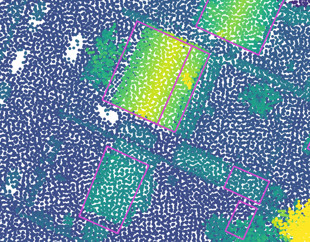
First example of misalignment with the LIDAR HD.
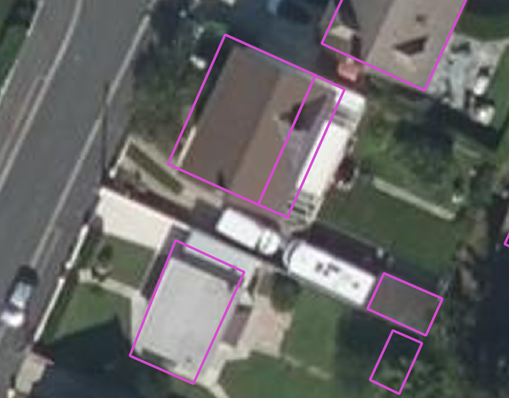
First example of misalignment with the BD ORTHO.
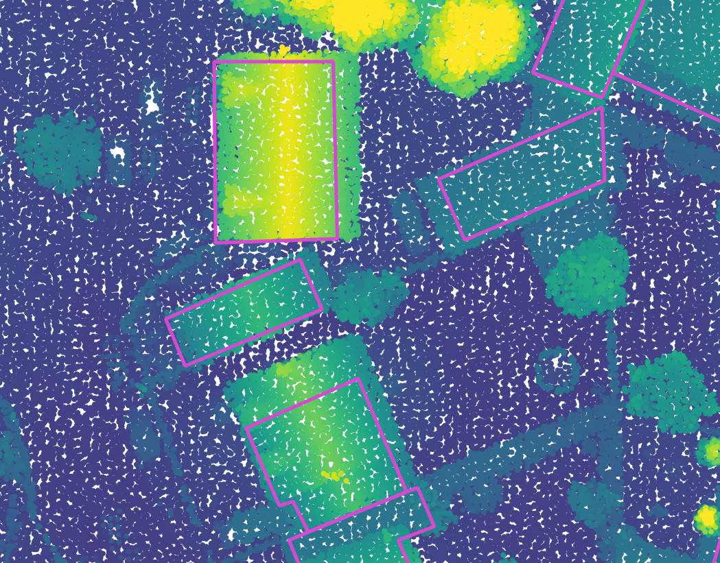
Second example of misalignment with the LIDAR HD.
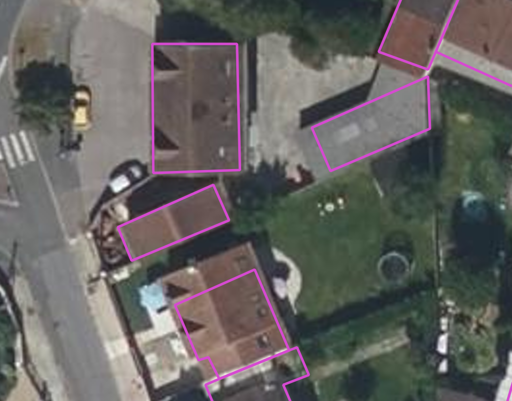
Second example of misalignment with the BD ORTHO.
Figure 1: Two examples of the misalignment of BD TOPO with other data.
Discussion
Balconies and awnings aren’t really a focus of the project so the small differences between BAG and BGT are not really of use to us.
According to Bruno there hasn’t been yet any ML model outputting polygons that gave convincing and robust results, so this solution doesn’t seem to be a good bet, and computing a robust geometric solution at the end to compute the polygons seems more promising. I can still try to look at a few papers.